The Trail at Reservoir Park Doesn't Actually Go Anywhere Yet
Most people who walk the loop at Reservoir Park could describe it with their eyes closed. Cross the dam, catch the water on your left, duck under the tree canopy past the second bench, come back around near the boat ramp. Two miles, give or take, and you're back at your car. It's the default outdoor hour for a lot of Southern Pines households, the thing you do before the heat sets in or right after work.
What most of those same walkers don't know is that the loop they're picturing is a small fraction of what's actually out there, and that the piece connecting it to the rest of town's trail system has been missing for sixteen years. Not missing in a vague, someday-we'll-get-to-it way. Missing in the specific, documented sense that the town's own planning materials use: the trail network on the north side of Southern Pines and the trail network on the south side stop just short of each other, and the road that's supposed to close that gap only went out to bid this past March.
That gap, and what's finally happening to close it, is the more interesting story than the loop itself.
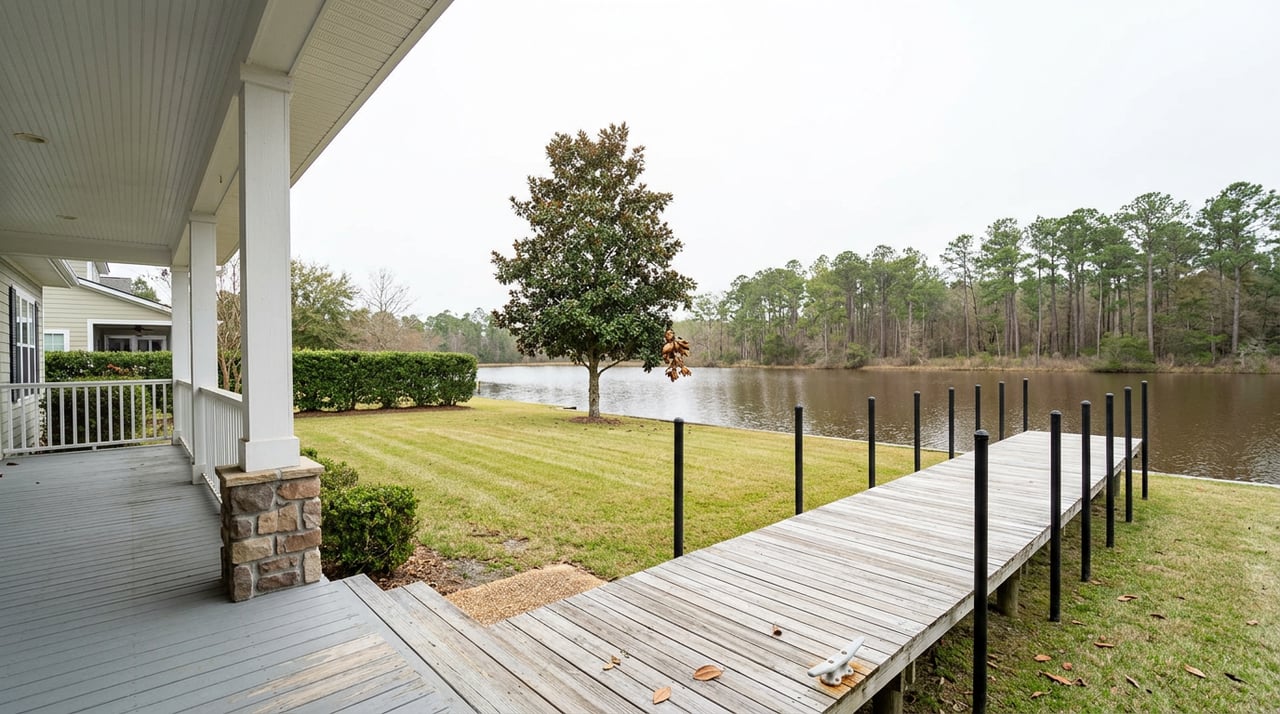
Reservoir Park proper covers 165 acres and holds a 95-acre lake that once supplied Southern Pines with its drinking water. The 2-mile loop everyone knows runs along that lake, including a stretch across a spillway bridge and a path directly on top of the dam holding the water back. But the park's official trail mileage runs past 12 miles once you count the branches that split off the main loop into the surrounding woods.
Then there's Whitehall, the 157-acre tract directly north of Reservoir Park that the town bought in December 2020 for $1.65 million. Combined, Reservoir Park and Whitehall add up to roughly 326 acres, making the whole complex the largest municipally owned park south of the Triangle and the fourth largest in North Carolina. Most of Whitehall is still what the town calls passive recreation, meaning open fields, unimproved trails, and picnic spots rather than a paved loop, but the master plan the town council approved in May 2023 calls for eventually adding five more miles of trail once the tract is fully built out. Part of that land, 66.39 of the 157 acres, sits under a permanent conservation easement held by the Three Rivers Land Trust, and the site is documented habitat for the endangered red-cockaded woodpecker, which is part of why the pace of development there has been deliberate rather than fast.
So the "park" most residents have in their heads, the lake and its loop, is roughly half of what actually exists on the ground.
Here's the part that explains why a resident on the south side of town can't currently bike from their neighborhood to Reservoir Park without getting in a car first. The town's greenway system was built in two separate pieces: the network anchored around Reservoir Park to the north, and a growing system of connector trails south of Midland Road, including the Forest Creek Access Trail, the Tall Timbers Trail, and the Mill Creek Trail. According to the town's own project materials, those two networks currently terminate at the same intersection, Knoll Road and Midland Road, without actually joining.
Knoll Road is the fix, and it's been the fix on paper since October 2010, when Southern Pines adopted a bicycle and pedestrian plan built on input from roughly 400 residents. That plan identified the Knoll Road corridor, between Airport Road and Midland Road, as the missing connector. The town submitted the project to the North Carolina Department of Transportation in 2014, and traffic studies followed in 2019 and 2021. Homeowners in the Longleaf community, whose entrance signage and landscaped medians sit along the corridor, had enough questions about narrowing the road that the town built a standalone FAQ page just to walk through what would and wouldn't change. It took until early 2026 for the design to reach 100 percent and go out to bid.
The plan itself is straightforward: take Knoll Road from three lanes down to two, reduce the posted speed from 40 miles per hour to 35, and use the reclaimed lane width to build a planted buffer and an 8 to 10-foot multi-use path wide enough for walkers, wheelchair users, and cyclists. The town's engineering team designed it with Kimley-Horn, and after a pre-bid meeting in February, sealed construction bids opened on March 12, 2026, with Fred Smith Company building it. Sixteen years after the plan first named this stretch of road as the missing piece, it is now, finally, a construction project with a contractor attached to it rather than a line item in a report.
The dam at the center of the loop predates almost everything else discussed here. It was built around 1924 to hold back the lake that would go on to serve as the town's drinking water supply for decades, and it hasn't had major repair work done to it since the 1990s. That's a hundred-year-old structure carrying foot and bike traffic across its top on any given morning, and it's part of why the town has been looking at ways to better manage water levels ahead of major storms rather than waiting to react after one arrives.
That question of storm readiness isn't hypothetical for Southern Pines. On July 6, 2025, Tropical Storm Chantal stalled directly over the town and dropped 8 to 10 inches of rain in a matter of hours, an event the town's own post-storm assessment classified as a 500-to-1,000-year flood. The damage wasn't limited to streets and yards. It hit the trail network specifically, and the town's recovery updates named the casualties directly:
The town worked through those repairs on a rolling basis rather than waiting to reopen everything at once, which is worth knowing if you're planning a specific loop rather than just showing up. A closure on one segment doesn't necessarily mean the whole park is affected, and it doesn't necessarily mean storm damage either, given that a couple of these same trail names are now also part of active Knoll Road construction.
None of this is presented as a warning. It's context that changes how you'd plan a season out there. If you've been avoiding a particular stretch near Knoll Road because of construction fencing, that's the connector project finally moving, not a stalled one. A closure that seems to be lingering longer than routine maintenance would explain is more likely tied to one of these two overlapping projects than to neglect. And if you've only ever walked the lake loop, Whitehall's open fields and unimproved paths sit right next door, already accessible today even though the five additional miles of built trail are still ahead.
The throughline across all of it is that Reservoir Park isn't a finished amenity sitting still. It's mid-transformation on three fronts at once: a connector road under construction after sixteen years of planning, a century-old dam getting attention before the next major storm rather than after, and storm damage still being worked off the list trail by trail. The version of the park you'll be walking a year from now, once Knoll Road's path is open and Whitehall's next phase moves forward, will look different from the one you know today, and not because of a rebrand or a ribbon-cutting. It's the accumulation of a lot of specific, dated work finally catching up to a plan that's been sitting on paper since 2010.
That kind of layered, slow-moving change is part of what makes a place worth paying attention to over years rather than just visiting once. If you're weighing what life actually looks like in a specific pocket of Southern Pines, from the parks people use to the projects reshaping them, I'm happy to talk through what I know. Reach out to Bill Sahadi — Let's Connect.

Whether you’re buying your first home, selling a trust property, or navigating a probate sale, my goal is always the same: to provide honest guidance, strong advocacy, and a smooth experience from beginning to end. Real estate is about people, not just properties. I would be honored to help you take your next step.

BILL SAHADI
1140 US HWY 1 SOUTH SOUTHERN PINES, NC 28387